Historyczne podziały administracyjno-polityczne, Instytut Historii im. Tadeusza Manteuffla PAN jest dostępne na licencji:
Creative Commons Attribution-NoDerivatives 4.0 International (treść)
Historyczne podziały administracyjno-polityczne, Instytut Historii im. Tadeusza Manteuffla PAN jest dostępne na licencji:
Creative Commons Attribution 4.0 International (dane)
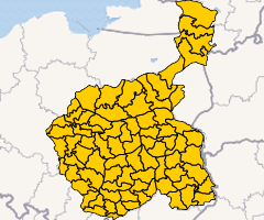
Zakład Atlasu Historycznego Instytutu Historii PAN im. Tadeusza Manteuffla od lat sześćdziesiątych XX wieku pracował nad serią “Atlas historyczny Polski. Mapy szczegółowe XVI wieku”. Projekt ten zakończył się w 2021 roku, a jednym z jego efektów jest rekonstrukcja podziałów administracyjnych ziem polskich Korony. Następnie w ramach projektu “Atlas historyczny Polski 2.0” przystąpiliśmy do dalszych prac mających na celu efektywne udostępnienie tych danych oraz opracowanie nowych o charakterze uzupełniającym. W odpowiedzi na postulaty środowiska naukowego opracowaliśmy szereg warstw z podziałami polityczno-administracyjnymi Polski, m.in. dla Prus po III rozbiorze (Prusy Zachodnie, Południowe, Nowowschodnie), Księstwa Warszawskiego, Królestwa Polskiego i Wielkiego Księstwa Poznańskiego. Prezentowane dane nie były harmonizowane, ani pod względem atrybutów (nazwy jednostek) ani geometrii. Różnice, szczególnie przestrzenne, które między nimi wynikają są skutkiem braku tej harmonizacji i różnych źródeł opracowania danych. Harmonizacja zasobu będzie częścią kolejnych prac. Szczegóły dotyczące poszczególnych warstw znajdują się w ich metadanych. Planujemy także dalszy rozwój zasobu i opracowanie innych jednostek polityczno-administracyjnych historycznych ziem polskich.
Uwagi czy propozycje uzupełnień prosimy zgłaszać na adres: atlasfontium@ihpan.edu.pl.
Prace zostały sfinansowane z projektu “Atlas historyczny Polski 2.0” (MNiSW, SONP/SP/466930/2020).
Tomasz Panecki


