
Ziemie polskie Korony w XVI w. Przestrzenna baza danych, Instytut Historii im. Tadeusza Manteuffla PAN jest dostępne na licencji:
Creative Commons Attribution-NoDerivatives 4.0 International![]()
![]()
![]() (treść)
(treść)
Ziemie polskie Korony w XVI w. Przestrzenna baza danych, Instytut Historii im. Tadeusza Manteuffla PAN jest dostępne na licencji:
Creative Commons Attribution 4.0 International![]()
![]() (dane)
(dane)
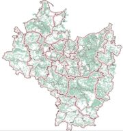
Prezentowane tutaj dane stanowią efekt prac nad serią Atlas historyczny Polski. Mapy szczegółowe XVI wieku, która została zakończona w 20211 roku i udostępniane są w kilku postaciach. Po pierwsze przez aplikację Web-GIS, pozwalającą na przeglądanie tych danych w formie cyfrowej mapy, na której – na tyle, na ile było to technicznie możliwe – odtworzona została symbolizacja z papierowych map Atlasu. Po drugie, w postaci możliwych do pobrania warstw z repozytorium danych w aplikacji GeoNode. Do udostępnianych warstw należą: miejscowości (zarówno w postaci warstwy zbiorczej, jak i podzielone na kategorie na potrzeby wizualizacji kartograficznej), granice (świeckie i kościelne), drogi i elementy pokrycia terenu (lasy, bagna, rzeki i jeziora). Dane w tej postaci przeznaczone są do samodzielnego przeprowadzania analiz geograficznych i opracowywania map historycznych m.in. przy pomocy programów typu desktop GIS (np. ArcGIS i QGIS). Po trzecie, do pobrania jest także tabelaryczna lista miejscowości w formie pliku *.xlsx, która zawiera listę wszystkich miejscowości objętych serią: obecnych w indeksie, a więc również tych niezlokalizowanych. Lista miejscowości zawiera ich atrybuty, takie jak: nazwa, charakter, rodzaj własności, rodzaj lokalizacji. Pełna lista atrybutów dostępna jest w metadanych pliku. Dostępna jest także wyszukiwarka miejscowości.
Pomimo zamknięcia serii i poszczególnych jej części, pełna prezentacja danych na niniejszej witrynie ma między innymi umożliwić zgłaszanie uwag i tym samym współtworzenie, dalsze rozwijanie i uzupełnianie tego dzieła. Uwagi czy propozycje uzupełnień prosimy zgłaszać na adres: atlasfontium@ihpan.edu.pl.
Tomasz Panecki
- Dokładniejszy opis serii dostępny jest w publikacji Corona Regni Poloniae.[↩]