
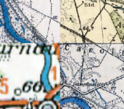
In 2011, Cartomatic launched the geoportal ‘Maps with the Past’, which presents mosaicked and georeferenced old maps, including topographic maps of the Polish Military Geographical Institute from the interwar period, Prussian and German maps from the 19th century, Prussian and German maps or old city maps. The materials were created by students of cartography at the Faculty of Geography and Regional Studies at the University of Warsaw as part of their internship at Cartomatic. Access to the maps was possible not only via the Geoportal, but also via the Web Map Service (WMS) geodata services. The interest in the data was great: it was not only used by scientists (archaeologists, geographers, historians), but also by anyone interested in geohistory.
In mid-2022, the geoportal was shut down for technical reasons, denying many people access to this extremely valuable and precious material. Shortly afterwards, the Department of Historical Atlases at the Institute of History of the Polish Academy of Sciences in Warsaw (ZAH) offered to take over the maintenance of the maps developed and made available by Cartomatic until then. Work began in August 2022 and the data was transferred to new servers and made available as WMS services by Warsaw University of Technology through CENAGIS infrastructure. A WebGIS application was then developed to access the maps. The application allows zooming in and out, enabling/disabling layers, changing transparency and searching for locations. To the maps provided by Cartomatic, ZAH staff have added others: the Gaul/Raczyński map (1:125 000, 1807-1812), the Schroetter map (1:150 000, 1796-1802), the Gilly map (1:150 000, 1802-1803) and the Chrzanowski map (1:300 000, 1859). It is planned to add further cartographic works to the services and applications.
Please send your comments or suggestions for additions to: atlasfontium@ihpan.edu.pl.

All maps and data “Maps of the Past” Institute of the History Polish Academy of Sciences are licenced under a Creative Commons Attribution-NonCommercial 4.0 International License..