
http://atlas.ihpan.edu.pl/geoserver/gaul/wms
Lista dostępnych warstw (układ 2180):
| Forests (Lasy) | Hydro_line (Rzeki) | Hydro_polygon (Akweny) |
| Industrial (Zakłady przemysłowe) | Natural_landscape (Nazwy fizjograficzne) | Roads (Drogi) |
| Settlements (Miejscowości) | Swamps (Bagna) | Sheets (Arkusze) |
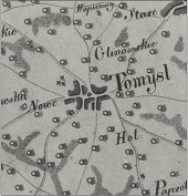
| mosaicked_color_v2 (Mapa połączona) | mosaicked_v3 (Mapa połączona kolorowa) | Districts (Powiaty) |

Cyfrowe edycje map dawnych: perspektywy i ograniczenia na przykładzie mapy Gaula/Raczyńskiego (1807-1812), autorzy, Instytut Historii im. Tadeusza Manteuffla Polskiej Akademii Nauk jest dostępny na licencji Creative Commons Uznanie autorstwa – Bez utworów zależnych 4.0 Międzynarodowe.