Religie i wyznania w Koronie w II połowie XVIII w., Bogumił Szady, Pracownia Geoinformacji Historycznej KUL jest dostępne na licencji:
Creative Commons Attribution-NoDerivatives 4.0 International (treść)
Religie i wyznania w Koronie w II połowie XVIII w., Bogumił Szady, Pracownia Geoinformacji Historycznej KUL jest dostępne na licencji:
Creative Commons Attribution 4.0 International (dane)
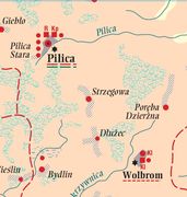
Mapa przedstawia obiekty sakralne oraz jednostki administracji terytorialnej wszystkich religii, wyznań i obrządków występujące na terenie Korony w II połowie XVIII wieku. W grupie świątyń chrześcijańskich znalazły się kościoły katolickie trzech obrządków (łacińskiego, greckiego, ormiańskiego), prawosławne, luterańskie (ewangelicko-augsburskie), mennonickie, kalwińskie (ewangelicko-reformowane) oraz czeskobraterskie (bracia czescy, mimo silnych tendencji unifikacyjnych z kalwinistami zostali potraktowani odrębnie). Wśród obiektów religii niechrześcijańskich dominowały świątynie żydowskie. Liczba meczetów muzułmańskich oraz kienes karaimskich w Koronie była niewielka.
Mapa opiera się głównie na źródłach i opracowaniach przynoszących systematyczne informacje o strukturach oraz rozmieszczeniu obiektów sakralnych religii i wyznań. Obejmuje w sumie 15 253 obiekty sakralne, w tym 8311 cerkwi unickich, 5720 kościołów łacińskich, 841 synagog i bożnic, 276 świątyń luterańskich, 35 cerkwi prawosławnych, 22 kościoły katolickie obrządku ormiańskiego, 19 świątyń mennonickich, 14 – kalwińskich, 10 – braci czeskich, 3 kienesy karaimskie oraz 2 meczety.
Ze strony aplikacji można pobrać także książkę B. Szadego, Geografia struktur religijnych i wyznaniowych w Koronie w II połowie XVIII w., Lublin 2010.
