
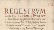
The Department of Historical Atlas of the Tadeusz Manteuffel Institute of History of the Polish Academy of Sciences had been working since the 1960s on the series ‘Historical Atlas of Poland. Detailed maps of the 16th century‘, hereinafter referred to as AHP for short. This project came to an end in 2021, and one of its results is the development of a digital edition of selected conscription registers – the primary source of information for the AHP.
The content of the registers can be viewed in two ways. The default and suggested one is to use the application ‘Tax registers of the Polish Crown in the second half of the 16th century‘. This is a WebGIS application, created on the basis of spatial data prepared during the AHP series and collected in a single database. The application makes it possible to view, from the map level, the information contained in the conscription registers from the second half of the 16th century about the towns from which tax was paid (or not). The second method is to refer to the ‘Data Atlas Fontium’ geohistorical data repository and download (*.xlsx, *.geojson, *.shp) the registers.
Full version of this text is available here [in Polish]: https://atlasfontium.pl/rejestry-poborowe-korony/
Please send your comments or suggestions for additions to: atlasfontium@ihpan.edu.pl.
WebGIS application [in Polish]: https://atlas.ihpan.edu.pl/rejestry-poborowe/
Search engine [in Polish]: https://atlasfontium.pl/miejscowosci_rejestry/
The work was financed from the project “Historical Atlas of Poland 2.0” (Ministry of Science and Higher Education, SONP/SP/466930/2020).
Michał Słomski, Tomasz Panecki