
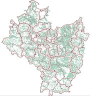
The map of Polish lands of the Crown in the 16th century – a spatial database, Instytut Historii im. Tadeusza Manteuffla PAN jest dostępne na licencji:
Creative Commons Attribution-NoDerivatives 4.0 International![]()
![]()
![]() (treść)
(treść)
The map of Polish lands of the Crown in the 16th century – a spatial database, Instytut Historii im. Tadeusza Manteuffla PAN jest dostępne na licencji:
Creative Commons Attribution 4.0 International![]()
![]() (dane)
(dane)
Abbreviations: s – gentry property, d – Catholic Church property, k – king property, m – town property.

Ziemie polskie Korony w XVI w. Przestrzenna baza danych, autorzy, Instytut Historii im. Tadeusza Manteuffla Polskiej Akademii Nauk jest dostępny na licencji Creative Commons Uznanie autorstwa – Bez utworów zależnych 4.0 Międzynarodowe.