
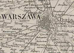
Abstract: The article presents the process and results of the development of a digital edition of the ‘Karta Dawnej Polski’ (KDP) [Map of Old Poland], published in Paris in 1859. Th etext outlines the history of the map, discusses its mathematical foundations, sources of information, and the scope of its content. The methodology for developing thedigital edition is also presented: the source of the edition, the calibration and mosaicking of the map sheets, the structure of the spatial database, andthe principles of map indexing, transcription, and transliteration of proper names, and identifi cation of selected localities. The method of publishing the digital edition is explained. The authors also attempted to assess the map’s reliability.
The full article is available exclusively in Polish.